
GAIA-MOBILE: Mobile Gravimetry for Moving Platforms Across Land, Sea, Air and Space.
Our mobile gravimetry programme is developing the next generation of gravity measurement: compact, rugged sensors that go where fixed-station and handheld instruments can't, mounted directly on moving and autonomous platforms. GAIA-MOBILE combines a MEMS accelerometer-based gravity sensor with the navigation and motion-compensation systems needed to separate the true gravity signal from the vehicle's own movement: the core engineering challenge of measuring gravity from something that isn't standing still.
Key Features
- Ultra-compact MEMS gravity module (13 cm diameter; next-generation module under 5 cm in development)
- Designed for deployment on underwater drones, blimps, rovers and other autonomous systems
- Robust, shock-tolerant architecture suited for mobile and dynamic environments
- Low-cost, low-power sensor platform, built for fleet-scale deployment
- Supports terrestrial, airborne, subsea and orbital gravimetry applications
- Adaptable form factor for tight payload envelopes and multi-sensor integration
- Roadmap includes advanced gradiometry and inertial-assisted operation, fusing accelerometer data with onboard navigation systems to isolate gravity signal from platform motion
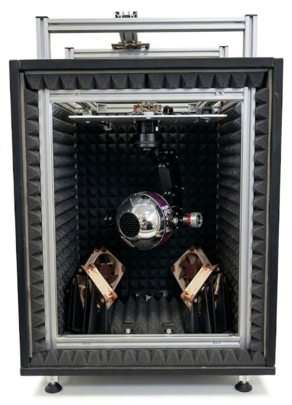
GAIA-MOBILE is currently undergoing proof-of-concept trials across a range of mobile and autonomous platforms. We're actively looking to partner with research institutions and commercial organisations to validate GAIA-MOBILE in real-world mobile and dynamic environments.
Talk to Our ExpertsApplications of Mobile Gravimetry
Because mobile gravimetry collects gravity measurements continuously as a platform moves, rather than one static reading at a time, it can cover large areas faster and more cost-effectively than traditional stationary surveys, while also reaching terrain that's hard to access with fixed instruments. That makes it useful across several fields.
- Geophysics and exploration: mapping underground density contrasts and mass distribution to characterise subsurface geology.
- Navigation: using high-resolution gravity maps for gravity-aided navigation on autonomous land, maritime and subsea platforms operating where GNSS is degraded, denied or unavailable. See our defence applications page and Alternative Navigation for Underwater Vehicles Using Gravity.
- Hydrology: monitoring groundwater depletion and replenishment over time.
- Geodesy and surveying: building higher-resolution geoid models, and helping bridge the resolution gap between satellite gravity missions and traditional ground surveys.
- Airborne and orbital platforms: extending gravimetry to UAVs and, longer term, orbital and planetary applications; see our aerospace applications page.
GAIA-MOBILE's roadmap, inertial-assisted operation and advanced gradiometry, is aimed squarely at the core technical challenge in this list: motion introduces additional accelerations that have to be separated from the true gravity signal before any of the above applications become possible from a moving platform.